A low-altitude surveillance radar has one core purpose: to keep watch over low-altitude airspace and turn possible risk targets into usable information. It is not a camera, and it is not a complete mitigation system by itself. It is the search and tracking layer that tells the security system where a target is, where it is moving, how fast it is moving, and whether it has entered an area that matters.
Many first-time buyers ask, “Can it see drones?” That question matters, but it is too narrow. The more useful engineering question is whether the radar can form stable tracks in the buyer’s real environment, deliver the right alerts to operators, and work with EO/IR cameras, RF detection, command software, and response procedures.
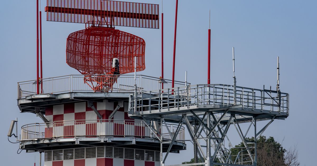
It Detects Low-Altitude Targets
Low-altitude surveillance radar scans a defined airspace and searches for small drones, low-flying aircraft, slow targets, or other moving objects of interest. Unlike a camera, radar does not depend on visible light and does not need to know exactly where to look before it starts searching. If the target is inside the radar’s coverage, line of sight, and performance envelope, the radar can actively detect it.
For counter-UAS applications, early detection is valuable. A drone may not be extremely fast, but low-altitude flight leaves little time because distances are short, obstacles are common, and the operator must still confirm the event and decide what to do.
Detection is not a promise to see everything. Small drone size, material, altitude, aspect angle, flight path, and clutter all affect performance. A credible radar supplier should explain the operating conditions behind any detection claim.
It Turns Detections into Tracks
A radar does not only produce isolated points. A practical system associates repeated detections over time and turns them into tracks. A track can show range, bearing, height, speed, direction of travel, and recent history.
Tracks are more useful than single detections. A single point may be noise, a bird, a vehicle reflection, moving vegetation, or another environmental effect. A continuous track helps the system decide whether the target is real, whether it is moving consistently, and whether it is approaching a protected zone.
For operators, a track answers the operational question: where did the target come from, where is it going, and how much time is left?
It Supports Zone-Based Alerts
Low-altitude security is not about alarming on every object. Real sites may include birds, vehicles, cranes, legal flight activity, people, vegetation, or background interference. If every radar point becomes an alarm, the system quickly becomes unusable.
Low-altitude surveillance radar is usually combined with geofences, warning zones, exclusion zones, direction rules, speed rules, and dwell-time logic. The system may raise the alert level only when a target enters a specific zone, approaches from a sensitive direction, remains in place unusually, or continues toward a core asset.
This helps the security team focus on events that need attention. For many projects, alert logic and false-alarm control are more important than a headline maximum range number.
It Cues Cameras and Other Sensors
Radar is strong at search and tracking, but it does not visually identify the target. If the operator needs to confirm whether the object is a drone, estimate its type, or see whether it carries a payload, the system usually needs EO/IR cameras, visible-light video, thermal imaging, RF detection, or manual confirmation.
One of radar’s key values is sensor cueing. After radar detects a target, it can send bearing, elevation, range, and track information to a pan-tilt camera. The camera can then move quickly toward the target area instead of requiring an operator to search a wide video scene manually.
In a complete counter-UAS system, radar often handles detection and tracking, EO/IR handles confirmation and evidence, RF detection can add control-link information, and the command platform handles alerting, logging, workflow, and response coordination.
It Builds Low-Altitude Situational Awareness
Low-altitude surveillance radar is not only a single-alarm device. It can also be part of an airspace situational awareness layer. When multiple radars, sensors, and software are combined, the system can show target distribution, track history, risk zones, and event records on a map.
This matters for airports, energy sites, data centers, industrial parks, ports, borders, event security, and urban low-altitude management. Security teams need more than “there is a drone.” They need to know where it is, how far it is from key assets, whether it is still approaching, whether there are other targets, and whether the event can be reconstructed later.
Situational awareness reduces uncertainty. The better the system organizes location, time, track, and evidence, the easier it is to make a defensible response.
It Does Not Solve Everything Alone
Low-altitude surveillance radar is important, but it should not be treated as a standalone answer. It has limits:
- buildings, terrain, trees, and metal structures can create blocked sectors;
- very small targets, very low flight paths, or difficult aspect angles can reduce detection probability;
- birds, vehicles, water, vegetation, and construction activity can create clutter;
- radar normally cannot identify visual appearance the way a camera can;
- mitigation, law enforcement, response, and evidence handling require additional systems and procedures.
This is why mature projects evaluate radar as part of a complete system instead of asking only how far one radar can see.
What Buyers Should Evaluate
When evaluating low-altitude surveillance radar, make the questions concrete:
- What area must be monitored, and which directions matter most?
- Are the targets consumer quadcopters, racing drones, fixed-wing drones, or larger low-altitude aircraft?
- Does the site include buildings, trees, water, roads, power lines, or other clutter sources?
- Is 2D information enough, or is height accuracy important?
- Can the system maintain stable tracks, not just scattered detections?
- Is the false-alarm rate acceptable at the real site?
- Can it cue EO/IR cameras, RF sensors, and command software?
- Do alert records, playback, and evidence export match the security workflow?
These questions are closer to real project value than a single “how many kilometers” answer.
Conclusion
The core value of low-altitude surveillance radar is continuous detection, location, tracking, and alerting in complicated low-altitude airspace. It gives security teams time to confirm and respond. It is not the device that visually identifies every drone, and it is not a complete mitigation solution by itself.
Useful low-altitude surveillance comes from the combination of radar performance, site design, alert rules, sensor integration, and operator workflow. Procurement should evaluate the radar inside that full environment, because that is where its real value becomes clear.